


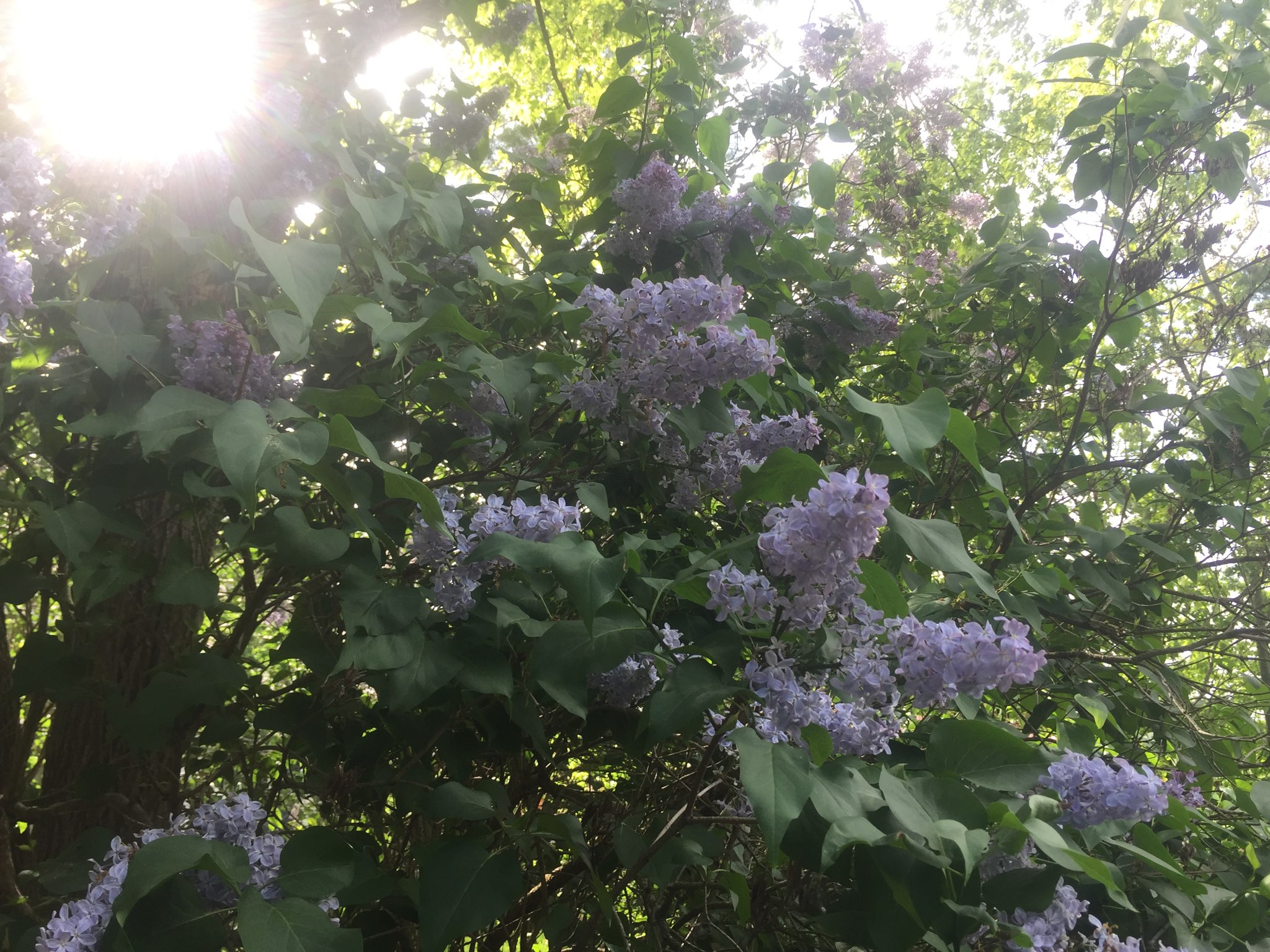
Spring in South Frontenac is simply fabulous when farm fields awaken from their winter blanket of snow, and bright green leaves bud against a backdrop of blue skies and shimmering lakes.
The peak is at the end of May and beginning of June when fields of lilacs, planted as wind barriers centuries ago erupt in full bloom, their intoxicating scent filling the air. Here are three great drives with stops for hikes to see the lilacs in all their glory this spring. Remember to roll down your windows and enjoy.
| Sunbury and Rideau Canal |
|
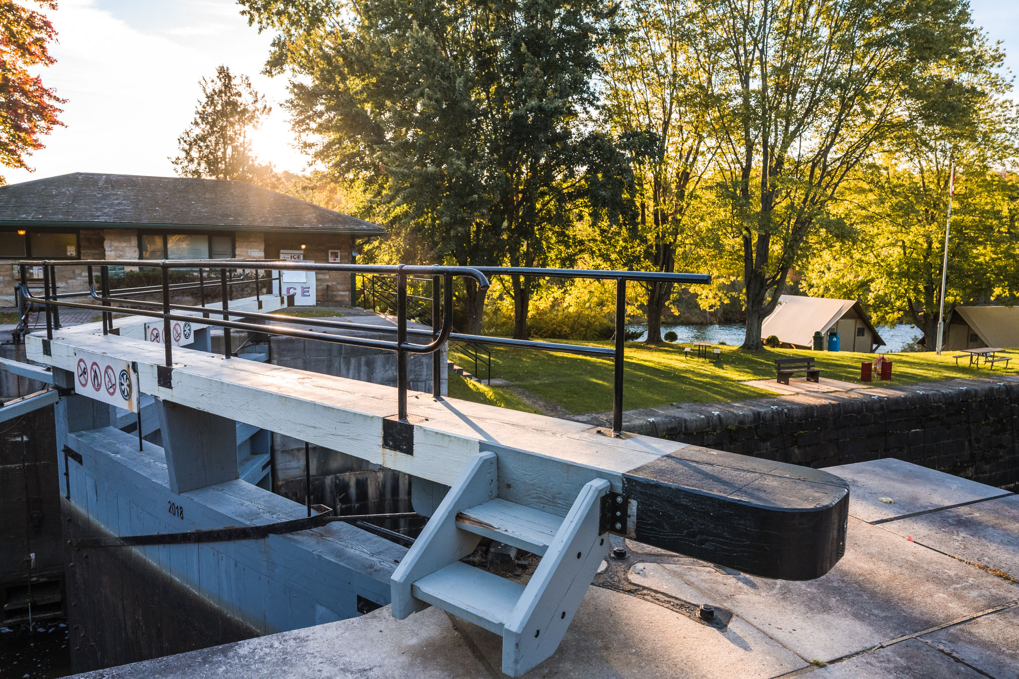
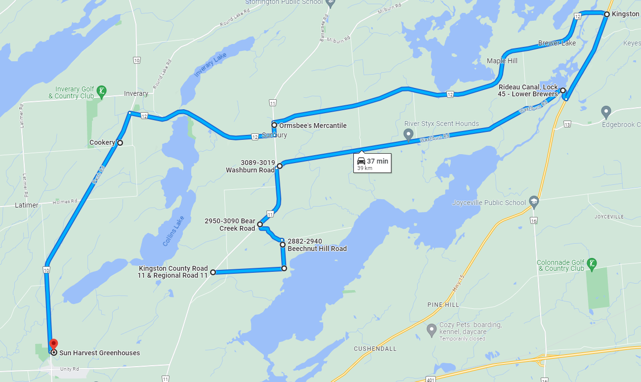
Length: 39 km Route Map: Google map Tour Route Drive north from Kingston on Montreal Street/Battersea Rd, admiring fields of lilacs on your way. Turn right at Mt. Chesney Rd and breathe in the beautiful smells. Follow the curve onto Beechnut Hill Road and turn left on Bear Creek Rd back to Battersea Rd. Head north again, turning right at Washburn Rd until the end. Plan a stop at the Rideau Canal at Lower Brewers Lock before heading north up Highway 15. Turn left onto Sunbury Rd through idyllic pastures and farmland. Grab a sandwich at Ormsbee’s Mercantile in Sunbury or keep going along Moreland Dixon Road until a stop for lunch at The Cookery in Inveray. On your way home south on Perth Rd, stop at Sun Harvest Greenhouses for fresh flowers or annuals or perennials for the garden. Maybe buy a lilac tree of your own!
|
| Harrowsmith and Holleford |
|
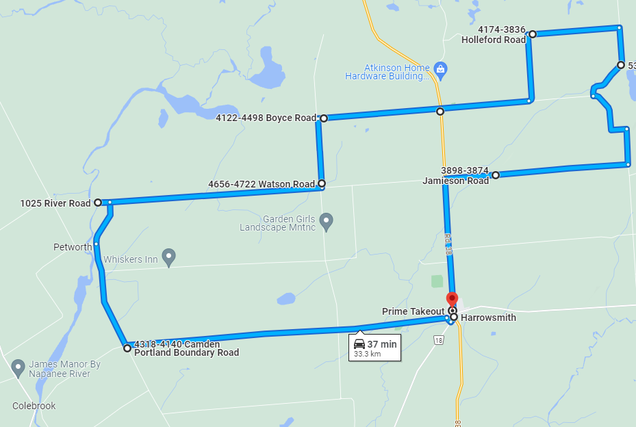
Length: 33.3 km Route Map: Google map Tour Route Drive north from Kingston on Highway 38. You’ll begin to see fields of lilacs on either side. Stop in Harrowsmith for a hike or bike ride on the K&P or Cataraqui Trail which intersect here (or you can stop on your return trip home). Turn left onto Colebrooke Road where fields of lilacs surround picturesque limestone homes. Turn right (north) on Camden Portland Boundary Road and take a little detour left to 1025 River Road in Petworth, a Township-owned water access point on the Napanee River—a great spot to canoe or kayak. Travel east on Petworth Rd, turning north on Watson Rd, then right on Boyce Rd to take you back to Highway 38. Stop in Hartington to see if the South Frontenac Museum is open (usually Mon, Wed and Sat during the warmer months from 1-4) or Hartington Community Caring in the Princess Anne Centre where you can find second-hand treasures. Continue east on Holleford Road and take your first left, then right (all of this is still Holleford Rd!) until you come to the famous Holleford Crater where a meteor hit millions of years ago. Stop for a selfie. Head south and back to Highway 38. Stop in Harrowsmith at Gilmour’s Meats to pick up something to barbecue for dinner, Prime Take-out for great take-out food or pizza.
|
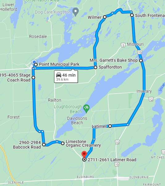
| Sydenham, Spaffordton and Latimer |
|
Length: 39.6 km Route Map: Google map Tour Route Drive north on Sydenham Rd, making your first stop the Limestone Organic Creamery to pick up some home baking or fresh milk products. Just north of the creamery, turn left onto Kepler Rd, then north on Babcock Rd to Orser Rd. Make a quick left, then right north on Stage Coach Rd into the village of Sydenham. Stop at the Point Park to have a picnic or swim or park at the municipal offices and hike or bike the Cataraqui Trail. Head east out of town on Rutledge Rd and go north on Wilmer Rd at Spaffordton. If you prefer a more remote spot to hike, you can catch the trail here as well. Take either Norway Rd or Ritchie Rd to Division Street. Head south, stopping at Mrs. Garrett’s Bake Shop for sustenance. In the village of Inverary, turn right on either Latimer Rd or Holmes Rd which will take you back to Sydenham Rd. Stop at Davidson’s Beach at the end of Holmes Rd—a beautiful little beach to end your trip!
|
![]() Contact Us
Contact Us